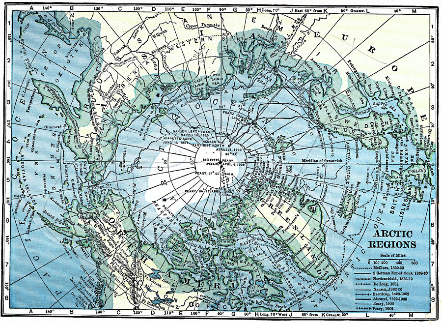
Description: A map of the North Polar Region from 1919 showing the routes of expeditions from 1850–1909 including the site of the sinking of the Jeanette, the route and date that Peary first reached the North Pole (April 6, 1909), and the routes of McClure (1850–1853), the German expeditions of 1869–1870, Nordenskiold (1878–1879), De Long (1881), Nansen (1893–1896), Sverdrup (1898–1902), Abruzzi (1899–1900), and the Peary expeditions of 1902 and 1906.
Place Names: Arctic Region, North America, �Asia, �Europ
ISO Topic Categories: location,
inlandWaters,
oceans,
transportation
Keywords: Arctic Regions, physical, �political, �transportation, physical features, location,
inlandWaters,
oceans,
transportation, Unknown, 1919
Source: Charles Morris, Winston's Cumulative Encyclopedia Vol 1 (Philadelphia, PA: The John C. Winston Company, 1919) tab 7
Map Credit: Courtesy the private collection of Roy Winkelman |
|