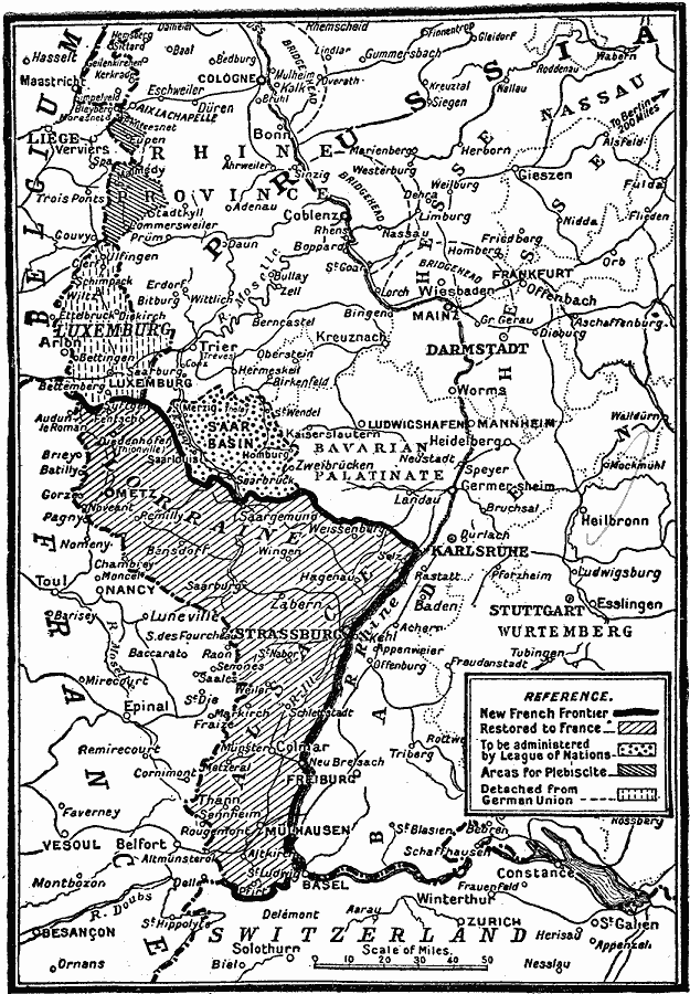
Description: A map from 1919 of the Alsace and Lorraine regions after World War I. In accordance with the terms of the Treaty of Peace, Alsace, and Lorraine were restored to France; the Saar Basin was taken out of German control for fifteen years; Luxemburg ceased to form part of the German Zollverein; Eupen and Malmedy were given Belgium.
Place Names: Western and Central Europe, Germany, �France, �Luxembour
ISO Topic Categories: boundaries,
location,
inlandWaters,
transportation
Keywords: German Concessions After World War One, physical, �political, �transportation, kVersailles, kWWI, physical features, country borders, railroads, boundaries,
location,
inlandWaters,
transportation, Unknown, 1919
Source: Charles Morris, Winston's Cumulative Encyclopedia Vol 1 (Philadelphia, PA: The John C. Winston Company, 1919) tab 14
Map Credit: Courtesy the private collection of Roy Winkelman |
|