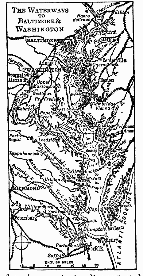
Description: A map from 1919 of the Chesapeake Bar area showing the waterways and railroad network between Baltimore and Washington, and includes the area east of Richmond.
Place Names: Middle Atlantic States, Washington D.C., �Baltimore, �Mid-Atlantic States, �Atlantic State
ISO Topic Categories: boundaries,
location,
oceans,
inlandWaters,
transportation
Keywords: Waterways to Baltimore and Washington, physical, �political, �transportation, physical features, local jurisdictions, water routes, boundaries,
location,
oceans,
inlandWaters,
transportation, Unknown, 1919
Source: Charles Morris, Winston's Cumulative Encyclopedia Vol 1 (Philadelphia, PA: The John C. Winston Company, 1919) tab 16
Map Credit: Courtesy the private collection of Roy Winkelman |
|