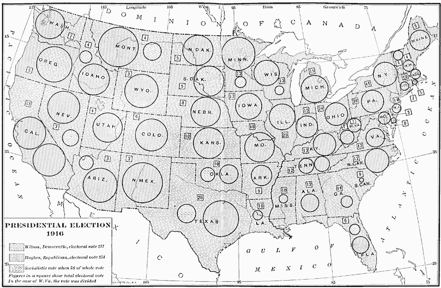
Description: A map of the United States showing the results of the 1916 presidential election. The map is keyed to show the states carried by the Democrats (Woodrow Wilson), Republicans (Charles Evans Hughes), and shows the Socialist Party votes (Allan Louis Benson) where they garnered at least 5 percent of the votes. The circles represent the number of the next highest vote for the candidate in respective shading, with figures in boxes indicating the number of Electoral Votes for each State.
Place Names: Elections, Presidential Electio
ISO Topic Categories: location,
oceans,
inlandWaters,
boundaries
Keywords: Presidential Election, physical, �political, physical features, country borders,
major political subdivisions, location,
oceans,
inlandWaters,
boundaries, Unknown, 1916
Source: Albert Bushnell Hart, LL.D., The American Nation Vol. 27 (New York, NY: Harper and Brothers, 1919) 380
Map Credit: Courtesy the private collection of Roy Winkelman |
|