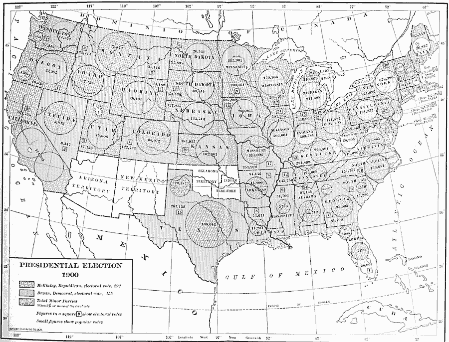
Description: A map of the United States showing the results of the 1900 presidential election. The map is keyed to show the states carried by the Republicans (William McKinley), Democrats (William Jennings Bryan), and the areas where minor parties garnered 5 percent or more of the votes. The circles represent the number of the next highest vote for the candidate in respective shading, with small figures showing the popular vote and figures in boxes indicating the number of Electoral Votes for each State.
Place Names: Elections, Presidential Electio
ISO Topic Categories: boundaries,
oceans,
location,
inlandWaters
Keywords: Presidential Election, physical, �political, physical features, country borders,
major political subdivisions, boundaries,
oceans,
location,
inlandWaters, Unknown, 1900
Source: Albert Bushnell Hart, LL.D., The American Nation Vol. 25 (New York, NY: Harper and Brothers, 1907) 132
Map Credit: Courtesy the private collection of Roy Winkelman |
|