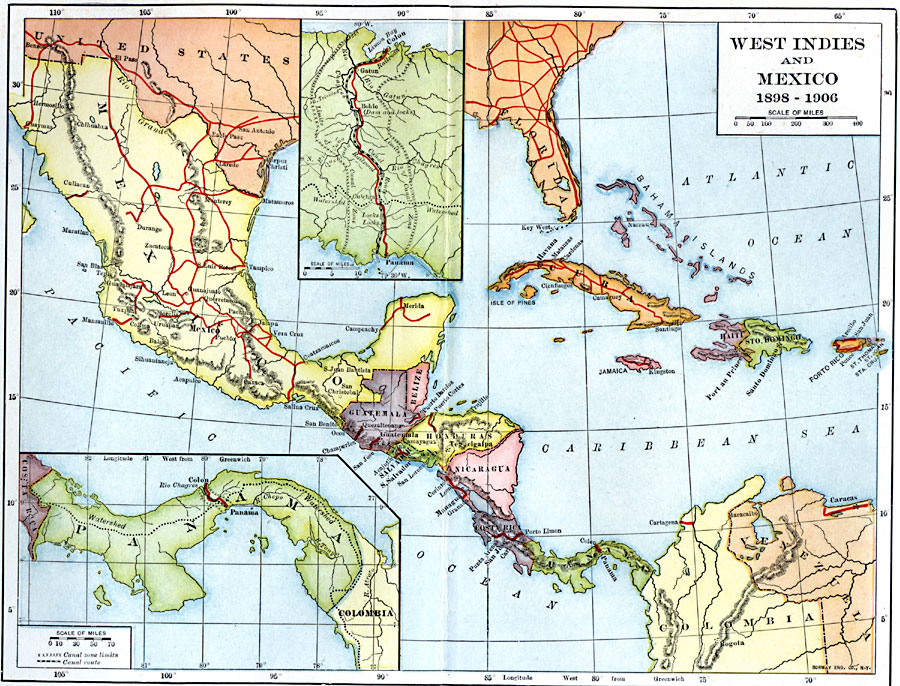
Description: A map from 1907 of Mexico, Central America, and the West Indies (Greater Antilles to Puerto Rico) between the Spanish–American War in 1898 and the Third Pan–American Conference in 1906. The map shows the political boundaries in 1906, capitals and major cities, railroads, rivers, islands, and the terrain and coastal features of the area. Two inset maps detail the Panama Isthmus, and the Panama Canal Zone showing the railroad and canal routes, with the canal lock locations.
Place Names: A Regional Map of North America, Mexico, �United States, �Bahamas, �Cub
ISO Topic Categories: boundaries,
oceans,
inlandWaters,
location
Keywords: The West Indies and Mexico, transportation, �physical, �political, physical features, country borders, water routes, boundaries,
oceans,
inlandWaters,
location, Unknown, 1898–1906
Source: Albert Bushnell Hart, LL.D., The American Nation Vol. 25 (New York, NY: Harper and Brothers, 1907) 274
Map Credit: Courtesy the private collection of Roy Winkelman |
|