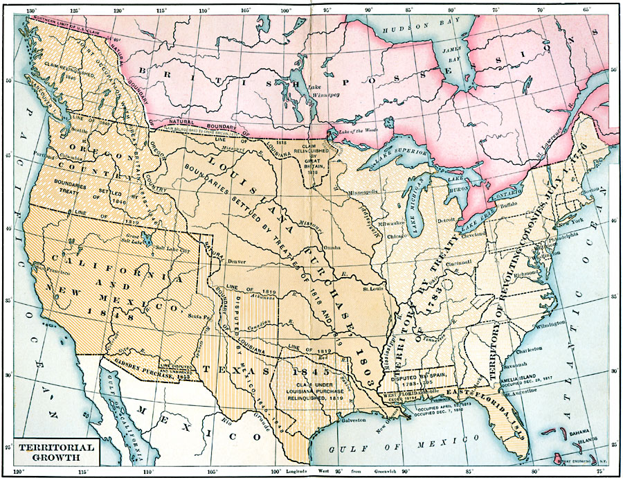
Description: A map from 1907 of the United States showing the growth of the nation from 1776–1853. This map is coded to show the thirteen original states, and the territories acquired in 1783, by the Louisiana Purchase in 1803, the northern territories, West Florida, and East Florida between 1810 and 1819, the western territories and Texas between 1845 and 1848, and the Gadsden Purchase in 1853.
Place Names: Growth of Nation, New York, �New Orleans, �Seattle, �Chicago, �Bosto
ISO Topic Categories: location,
oceans,
inlandWaters,
boundaries,
transportation
Keywords: Territorial Growth of the United States, physical, �political, physical features, country borders, location,
oceans,
inlandWaters,
boundaries,
transportation, Unknown, 1783–1853
Source: Albert Bushnell Hart, LL.D., The American Nation Vol. 26 (New York, NY: Harper and Brothers, 1907) 18
Map Credit: Courtesy the private collection of Roy Winkelman |
|