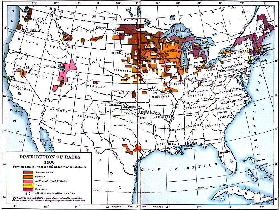
Description: A map from 1907 of the United States showing concentrations and distribution of various European ethnic groups in 1900. The map is color–coded to show foreign populations where 8 percent or more of the inhabitants are Scandinavian, German, Natives of Great Britain, Irish, or Canadians. Parti–colored lines indicate 8 percent or more of each nationality represented.
Place Names: Demographics, Boston, �Chicago, �Ethnicitie
ISO Topic Categories: boundaries,
oceans,
location,
inlandWaters
Keywords: Distribution of Ethnicities in the United States, physical, �political, kEthnic, physical features, country borders,
major political subdivisions, boundaries,
oceans,
location,
inlandWaters, Unknown, 1900
Source: Albert Bushnell Hart, LL.D., The American Nation Vol. 26 (New York, NY: Harper and Brothers, 1907) 46
Map Credit: Courtesy the private collection of Roy Winkelman |
|