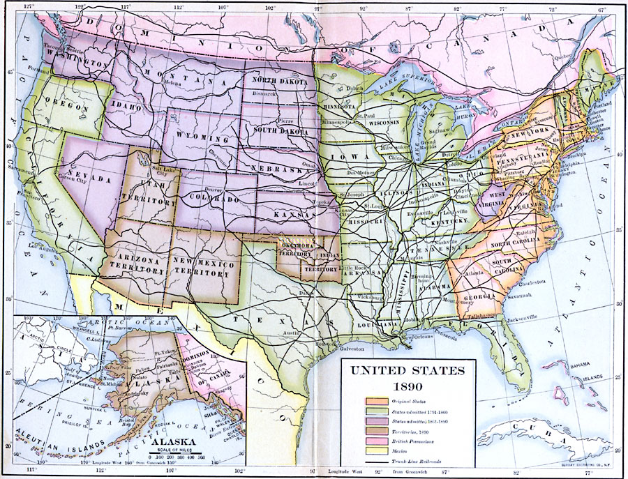
Description: A map from 1890 of the United States showing the territorial expansion from the original Thirteen Colonies to the states and territories of 1890. This map shows state capitals, railroads, lakes, and rivers. The map is color–coded to show the original states, states admitted between 1791 and 1860, states admitted between 1861 and 1900, the territories in 1890 (Arizona, New Mexico, Oklahoma and Indian Territory, and Alaska), and the possessions at the time of Britain (Dominion of Canada and Bahamas) and Mexico. An inset map shows the territory of Alaska.
Place Names: A Complete Map of the United States, Boston, �New York, �New Orleans, �Los Angeles, �Houston, �Chicago, �Seattle, �Washington D.C
ISO Topic Categories: transportation,
inlandWaters,
location,
oceans,
boundaries
Keywords: The United States, physical, �political, �transportation, physical features, country borders,
major political subdivisions, railroads, transportation,
inlandWaters,
location,
oceans,
boundaries, Unknown, 1890
Source: Albert Bushnell Hart, LL.D., The American Nation Vol. 24 (New York, NY: Harper and Brothers, 1907) 4
Map Credit: Courtesy the private collection of Roy Winkelman |
|