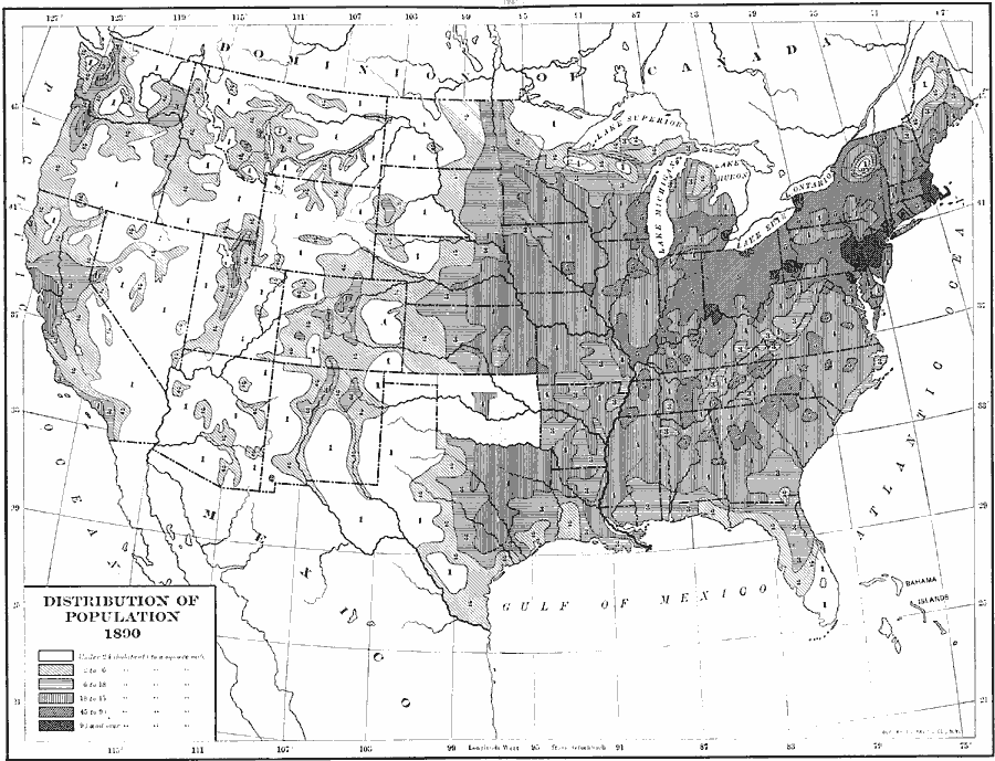
Description: A map of the United States showing the distribution of the population in 1890. The map is keyed to show areas of population with densities ranging from under 2 inhabitants per square mile to 90 and over inhabitants per square mile.
Place Names: Demographics, populatio
ISO Topic Categories: boundaries,
inlandWaters,
oceans,
location,
society
Keywords: Distribution of Population, physical, �political, kPopulation, physical features, country borders,
major political subdivisions, boundaries,
inlandWaters,
oceans,
location,
society, Unknown, 1890
Source: Albert Bushnell Hart, LL.D., The American Nation Vol. 24 (New York, NY: Harper and Brothers, 1907) 16
Map Credit: Courtesy the private collection of Roy Winkelman |
|