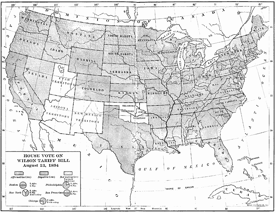
Description: A map of the United States showing the results of the House vote on the Wilson Tariff Bill (also known as the Wilson–Gorman Tariff Act or the Revenue Act), August 13, 1894. The proposed tariff was a reduction of the earlier McKinley Tariff Act of 1890, and included a provision to supplement lost revenue by imposing a 2 percent income tax, the first peacetime income tax in the United States. The voting break–outs for the cities of Boston, Philadelphia, New York, San Francisco, and Chicago are shown.
Place Names: Elections, House Vot
ISO Topic Categories: inlandWaters,
location,
oceans,
boundaries
Keywords: House Vote on the Wilson Tariff, physical, �political, physical features, country borders,
major political subdivisions, inlandWaters,
location,
oceans,
boundaries, Unknown, 1894
Source: Albert Bushnell Hart, LL.D., The American Nation Vol. 24 (New York, NY: Harper and Brothers, 1907) 274
Map Credit: Courtesy the private collection of Roy Winkelman |
|