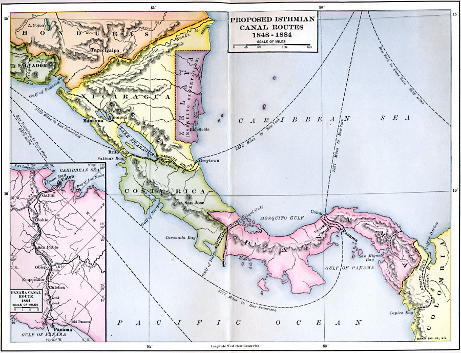
Description: Proposed routes for canals on the Central American isthmus.
Place Names: A Regional Map of North America, Nicaragua, �Costa Rica, �Panama, �Hondura
ISO Topic Categories: planningCadastre,
transportation,
boundaries,
inlandWaters,
location,
oceans
Keywords: Proposed Isthmian Canal Routes, physical, �political, �transportation, physical features, country borders, water routes, planningCadastre,
transportation,
boundaries,
inlandWaters,
location,
oceans, Unknown, 1848–1884
Source: Albert Bushnell Hart, LL.D., The American Nation Vol. 23 (New York, NY: Harper and Brothers, 1907) 207
Map Credit: Courtesy the private collection of Roy Winkelman |
|