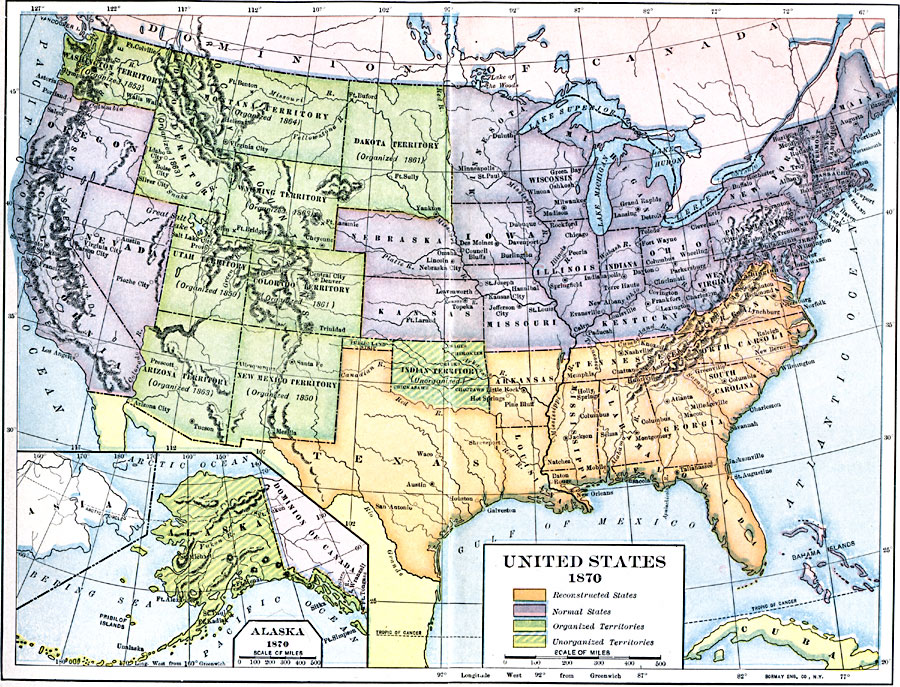
Description: A map of the United States and territories after the Civil War during reconstruction and readmission by 1870. The map is color–coded to show the ‘Normal States’ (Union States), the ‘Reconstructed States&’ (Confederate States), the Organized Territories (Washington, Idaho, Montana, Dakota, Wyoming, Utah, Colorado, Arizona, and New Mexico), and the Unorganized Territories (Oklahoma or Indian Territory, and Alaska).
Place Names: A Complete Map of the United States, Boston, �Chicago, �Houston, �Los Angeles, �New Orleans, �New York, �Seattle, �Washington D.C., �San Francisc
ISO Topic Categories: boundaries,
location,
oceans,
inlandWaters
Keywords: Reconstructed United States, physical, �political, physical features, country borders,
major political subdivisions, boundaries,
location,
oceans,
inlandWaters, Unknown, 1870
Source: Albert Bushnell Hart, LL.D., The American Nation Vol. 22 (New York, NY: Harper and Brothers, 1907) 4
Map Credit: Courtesy the private collection of Roy Winkelman |
|
