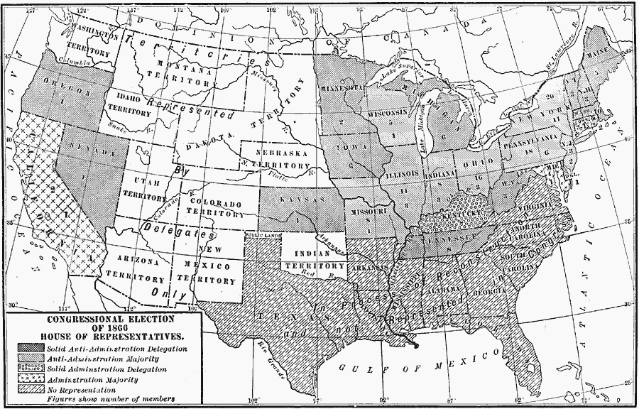
Description: A map of the United States showing the election results for the House of Representatives in 1866 under President Andrew Johnson. The map is keyed to show the states with a solid anti–administration delegation, states with an anti–administration majority, states with a solid administration delegation, states with an administration majority, and the southern states with no representation pending reconstruction. The figures on this map indicate the number of members. The territories had no vote and were represented by delegates only. The map shows the territorial boundaries at the time for Washington Territory, Montana Territory, Idaho Territory, Dakota Territory, Nebraska Territory, Utah Territory, Colorado Territory, Arizona Territory, New Mexico Territory, and Indian Territory with the panhandle shown as Public Land.
Place Names: Elections, Congressional District, �Congressional Election, �House of Representatives, �Congres
ISO Topic Categories: boundaries,
location,
oceans,
inlandWaters
Keywords: Congressional Election, physical, �political, physical features, country borders,
major political subdivisions, boundaries,
location,
oceans,
inlandWaters, Unknown, 1866
Source: Albert Bushnell Hart, LL.D., The American Nation Vol. 22 (New York, NY: Harper and Brothers, 1907) 82
Map Credit: Courtesy the private collection of Roy Winkelman |
|