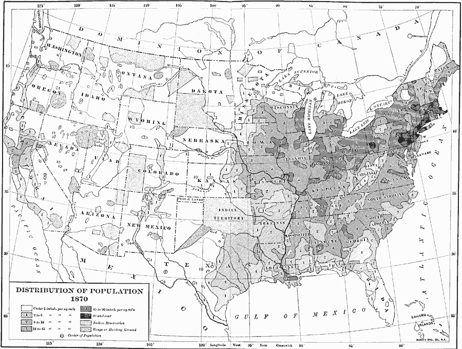
Description: A map from 1907 of the United States showing the distribution of the population in 1870. The map is keyed to show areas of population with densities ranging from under 2 inhabitants per square mile to 90 and over inhabitants per square mile. The mean center of population for the United States at the time was located in southern Ohio. This map also shows the Indian Reservations and areas of designated hunting grounds.
Place Names: Demographics, populatio
ISO Topic Categories: boundaries,
society,
inlandWaters,
location,
oceans
Keywords: Population Distribution, physical, �political, kNativeAmerican, kPopulation, physical features, country borders,
major political subdivisions, boundaries,
society,
inlandWaters,
location,
oceans, Unknown, 1870
Source: Albert Bushnell Hart, LL.D., The American Nation Vol. 22 (New York, NY: Harper and Brothers, 1907) 143
Map Credit: Courtesy the private collection of Roy Winkelman |
|