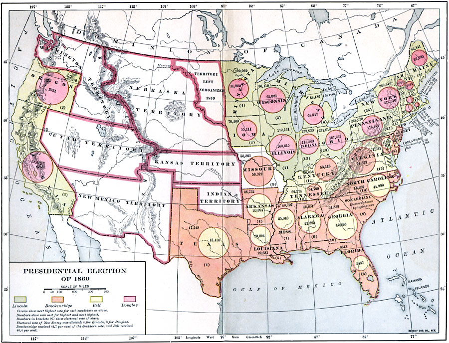
Description: A map of the United States showing the results of the presidential election of 1860. The map is color–coded to show the states carried by Lincoln (Republican), Breckinridge (Southern Democrat), Bell (Constitutional Union), and Douglas (Northern Democrat), with circles indicating the next highest vote for the candidate in respective color. The figures give the number of votes cast for the highest and next highest, with the number of electoral votes for the state given in parentheses. The territories of Washington, Nebraska, Utah, New Mexico, Kansas, Indian Territory (Oklahoma), and the northern unorganized territory east of the Missouri River were not entitled a vote in the election.
Place Names: Elections, Presidential Electio
ISO Topic Categories: boundaries,
inlandWaters,
location,
oceans
Keywords: Presidential Election, physical, �political, physical features, major political subdivisions,
country borders, boundaries,
inlandWaters,
location,
oceans, Unknown, 1860
Source: Albert Bushnell Hart, LL.D., The American Nation Vol. 19 (New York, NY: Harper and Brothers, 1907) 133
Map Credit: Courtesy the private collection of Roy Winkelman |
|