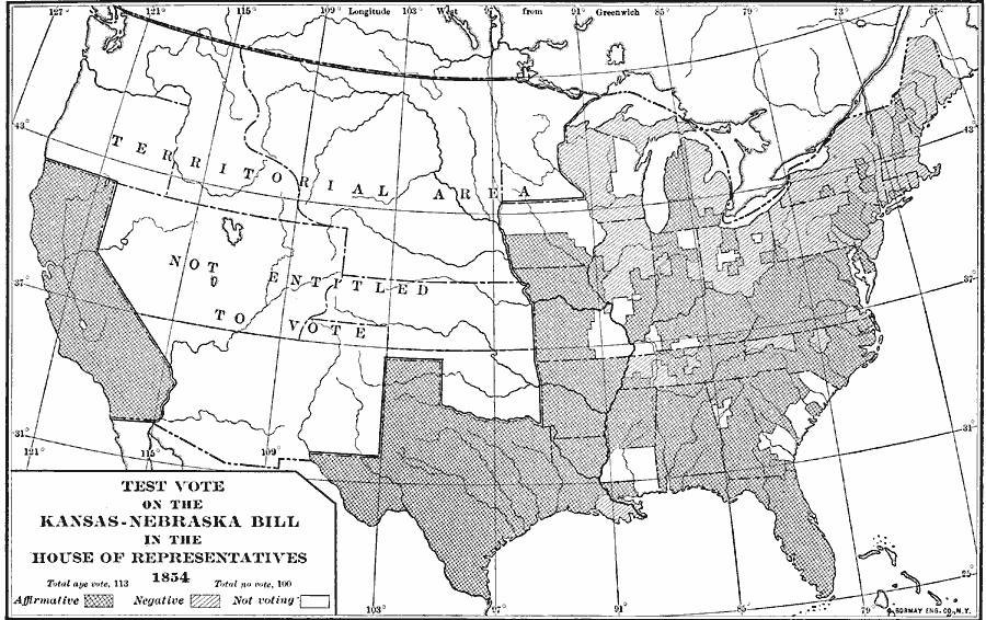
Description: A map of the United States in 1854 showing the results of the test–vote on the Kansas–Nebraska Bill in the House of Representatives, which would repeal the Missouri Compromise of 1820 and allow territorial settlers to determine if slavery would be prohibited or allowed within their boundaries. The map indicates that only states could vote on the issue, and the territories were not entitled to vote. The map is coded to show the areas voting for (113), against (100), and not voting, and shows the pattern of southern states tending to vote for, and northern states tending to vote against the measure.
Place Names: Elections, Kansas-Nebraska Bill, �Kansas-Nebraska Act, �Kansas-Nebraska, �Kansas Nebraska Act, �Kansas Nebraska Bil
ISO Topic Categories: boundaries,
location,
inlandWaters,
oceans
Keywords: Test-vote on the Kansas-Nebraska Bill, physical, �political, �transportation, physical features, country borders,
major political subdivisions, boundaries,
location,
inlandWaters,
oceans, Unknown, 1854
Source: Albert Bushnell Hart, LL.D., The American Nation Vol. 18 (New York, NY: Harper and Brothers, 1907) 106
Map Credit: Courtesy the private collection of Roy Winkelman |
|