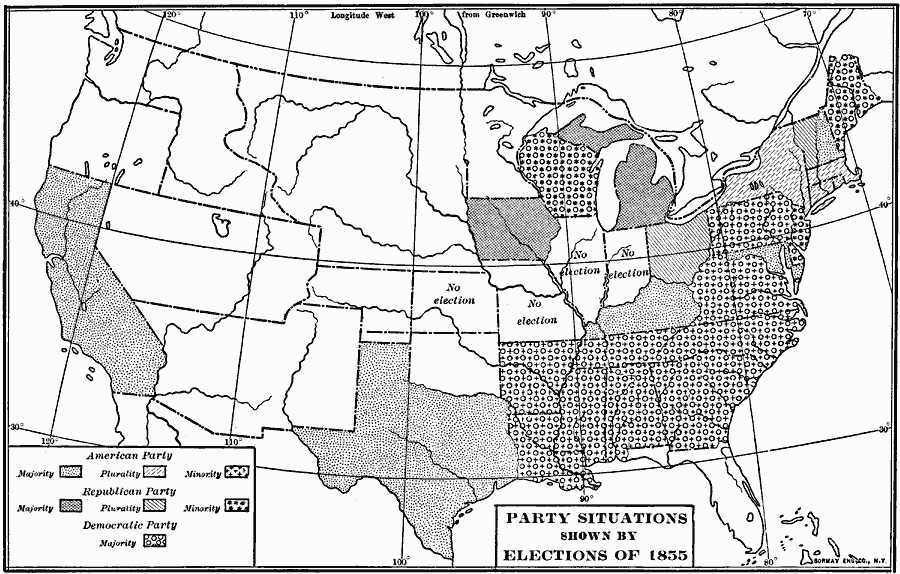
Description: A map of the United States showing the results of the 1855 State elections, indicating the political trends regarding the Kansas–Nebraska Act of 1854 and the slavery issue in the admission of Kansas into the Union.
Place Names: Elections, Presidential Election, �party situations, �parties, �part
ISO Topic Categories: boundaries,
location,
oceans,
inlandWaters
Keywords: Party Situations, physical, �political, physical features, country borders, boundaries,
location,
oceans,
inlandWaters, Unknown, 1855
Source: Albert Bushnell Hart, LL.D., The American Nation Vol. 18 (New York, NY: Harper and Brothers, 1907) 132
Map Credit: Courtesy the private collection of Roy Winkelman |
|