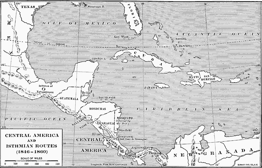
Description: A map of Central America during the period of westward expansion in the United States when the need to find a shorter practical shipping route from the east coast to the west coast was a principle concern. This map shows the proposed Tehuantepec route through Mexico, the Nicaraguan route from Greytown on the Atlantic (Caribbean) through Lake Nicaragua to San Juan del Sur on the Pacific, the Chiriqui route from the Chiriqui Lagoon on the Atlantic to the Pacific harbor of Golfo Dulce, and the Panama route from Aspinwall on the Atlantic to the City of Panama on the Pacific.
Place Names: A Regional Map of North America, Mexico, �Cuba, �United States, �Bahamas, �Guatemala, �Belize, �Honduras, �Nicaragua, �Costa Rica, �Panam
ISO Topic Categories: boundaries,
location,
oceans,
planningCadastre,
inlandWaters
Keywords: Central America and Isthmian Routes, kTransportation, boundaries,
location,
oceans,
planningCadastre,
inlandWaters, Unknown, 1846–1860
Source: Albert Bushnell Hart, LL.D., The American Nation Vol. 18 (New York, NY: Harper and Brothers, 1907) 246
Map Credit: Courtesy the private collection of Roy Winkelman |
|