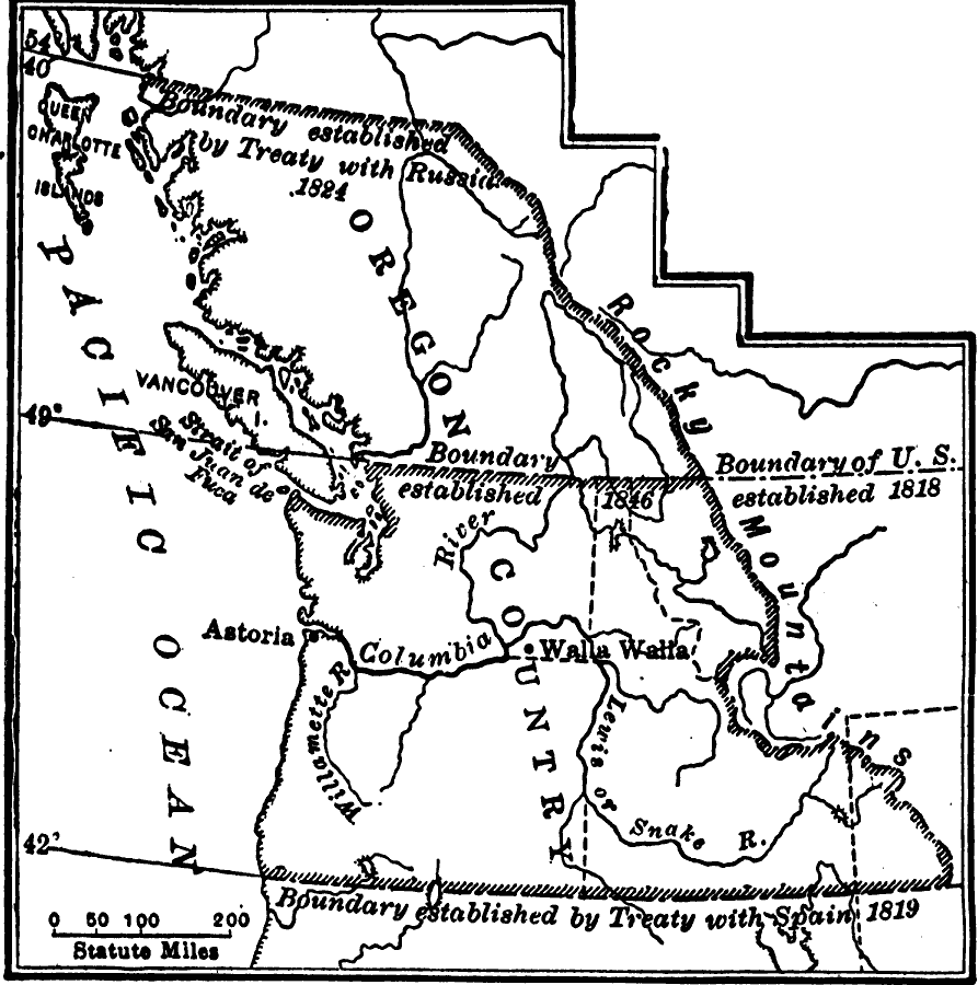
Description: A map of the Oregon Country showing the adjustments to the boundaries between 1818–1846, including the boundary established in 1818 to the east of the jointly controlled territory (Great Britain and the United States), the southern boundary established by treaty with Spain in 1819, the northern boundary established by treaty with Russia in 1824, and the boundary dividing the territory between the United States and Great Britain in 1846.
Place Names: Growth of Nation, Oregon country, �Rocky Moutains, �United States, �Washington,
ISO Topic Categories: oceans,
location,
inlandWaters,
boundaries
Keywords: The Oregon Country, borders, �historical, �physical, �physical features, historical event, oceans,
location,
inlandWaters,
boundaries, Unknown, 1818–1846
Source: S.E. Forman, Advanced American History (New York, NY: The Century Company, 1919) 349
Map Credit: Courtesy the private collection of Roy Winkelman |
|