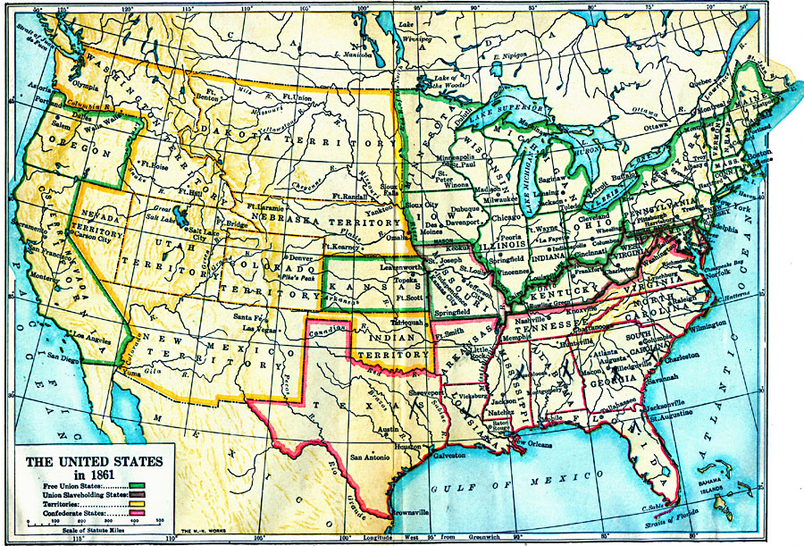
Description: A map of the United States in 1861 after the secession of the Southern States. The map is color–coded to show the Free Union States, Union Slaveholding States, Confederate States, and the territories of Washington, Dakota, Nevada, Utah, Nebraska, Colorado, New Mexico, and the Indian Territory (Oklahoma).
Place Names: Growth of Nation, Arkansas, �California, �Colorado territory, �Connecticut, �Dakota territory, �Delaware, �Florida, �Georgia, �Indian Territory, �Iowa, �Kentucky, �Louisiana, �Maine, �Massachusetts, �Michigan, �Minnesota, �Missouri, �Nevada territory, �New Hampshir
ISO Topic Categories: oceans,
location,
inlandWaters,
boundaries
Keywords: The United States, borders, �historical, �physical, �physical features, ethnological, historical event, oceans,
location,
inlandWaters,
boundaries, Unknown, 1861
Source: S.E. Forman, Advanced American History (New York, NY: The Century Company, 1919)
Map Credit: Courtesy the private collection of Roy Winkelman |
|