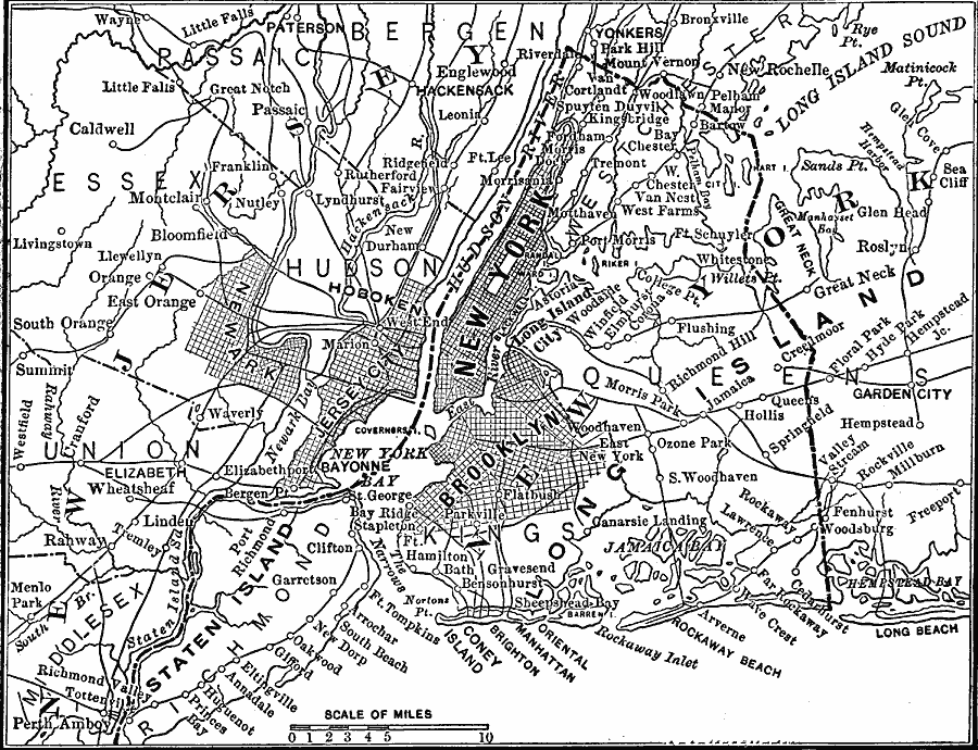
Description: A map showing Greater New York and vicinity between 1865–1898.
Place Names: New York, Brooklyn, �Coney Island, �Hudson River, �Long Island, �Manhattan, �New York City, �Rockaway Beac
ISO Topic Categories: oceans,
location,
inlandWaters
Keywords: Greater New York and Vicinity, physical, physical features, oceans,
location,
inlandWaters, Unknown, 1865–1898
Source: Edward S. Ellis, A. M., Ellis' History of the United States From the Discovery of America to the Present Time (Minneapolis, MN: Western Book Syndicate, 1899) 1687
Map Credit: Courtesy the private collection of Roy Winkelman |
|