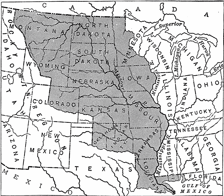
Description: A map of the Louisiana territory purchased from France in 1803, and the boundary established with the western Spanish territory by the purchase. The map overlays the current State boundaries to show the extent of the territory.
Place Names: Growth of Nation, Arkansas, �Iowa, �Kansas, �Louisiana, �Minnesota, �Missouri, �Montana, �North Dakota, �Oklahoma, �South Dakota, �Wyoming, �Louisiana Purchas
ISO Topic Categories: oceans,
location,
inlandWaters,
boundaries
Keywords: The Louisiana Purchase, borders, �historical, �land, �physical, �physical features, ethnological, water routes, historical event, oceans,
location,
inlandWaters,
boundaries, Unknown, 1865–1898
Source: Edward S. Ellis, A. M., Ellis' History of the United States From the Discovery of America to the Present Time (Minneapolis, MN: Western Book Syndicate, 1899) 1811
Map Credit: Courtesy the private collection of Roy Winkelman |
|