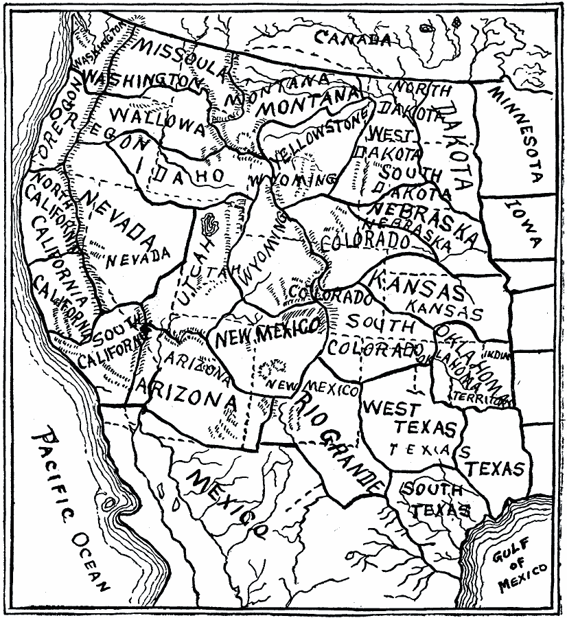
Description: A sketch map from 1899 of the western United States showing the present state boundaries (dashed lines) and states proposed between 1865 and 1898 (solid lines), including the states Yellowstone, Wallowa, West Dakota, South Colorado, and Rio Grande.
Place Names: Growth of Nation, Arizona, �California, �Colorado, �Idaho, �Iowa, �Kansas, �Minnesota, �Montana, �Nebraska, �New Mexico, �North Dakota, �Oklahoma, �South Dakota, �Texas, �Washington, �Wyomin
ISO Topic Categories: oceans,
location,
inlandWaters,
boundaries
Keywords: The Expanding United States, borders, �historical, �land, �physical, �physical features, country borders, ethnological, water routes, historical event, oceans,
location,
inlandWaters,
boundaries, Unknown, 1865–1898
Source: Edward S. Ellis, A. M., Ellis' History of the United States From the Discovery of America to the Present Time (Minneapolis, MN: Western Book Syndicate, 1899) 1827
Map Credit: Courtesy the private collection of Roy Winkelman |
|