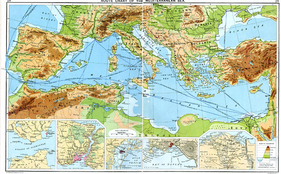
Description: A map from 1915 of the Mediterranean Sea and Black Sea region showing steamship routes with distances between ports given in nautical miles. The map uses color–contouring to show elevations from sea level to above 6000 feet and water depths at the 100 fathom line and below. The map shows principal cities and ports, railroads, rivers, and coastal features. Inset maps detail the important waterways and ports of the strait of Gibraltar, Constantinople and the Bosphorus, Venice, Naples, and the Suez Canal.
Place Names: Mediterranean Europe, Europe, �United Kingdom, �Sweden, �Spain, �France, �Germany, �Greece, �Italy, �Poland, �Portugal, �Romani
ISO Topic Categories: inlandWaters,
oceans,
location,
boundaries,
transportation
Keywords: Route Chart of the Mediterranean Sea, physical, �political, �borders, �boundaries, �transportation, �routes, ��physical features, country borders, water routes, inlandWaters,
oceans,
location,
boundaries,
transportation, Unknown, 1915
Source: J.G. Bartholomew, A School Economic Atlas (London, England: Oxford University Press, 1915) 28-29
Map Credit: Courtesy the private collection of Roy Winkelman |
|