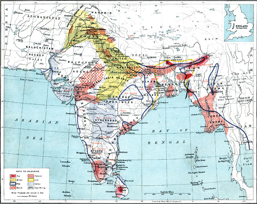
Description: A map from 1915 of British India, showing principal economic products of the region at the time. The map is color–coded to show areas where tea, wheat, rice, opium, tobacco, jute, and cotton are grown, and areas of coal extraction. Other, less primary products are named in red on the map. Major cities, trade centers and ports are shown, as well as railroads and rivers. The provincial names given reflect the East India Company interests related to local government entities, including the Baluchistan Agency, Rajputana Agency, Bombay Presidency, and Madras Presidency. An inset outline map of England at the same map scale is included to show comparative area size.
Place Names: India , Asia, �India,
ISO Topic Categories: inlandWaters,
oceans,
location,
boundaries,
transportation,
farming,
economy
Keywords: Economic Activity in India, physical, �political, �borders, �boundaries, �statistical, �agriculture, �industry, �economic, �transportation, �routes, �railroads, kComparativeArea,physical features, country borders, industry,
economic,
agriculture, water routes,
railroads, inlandWaters,
oceans,
location,
boundaries,
transportation,
farming,
economy, Unknown, 1915
Source: J. G. Bartholomew, A School Economic Atlas (London, England: Oxford University Press, 1915) 34
Map Credit: Courtesy the private collection of Roy Winkelman |
|