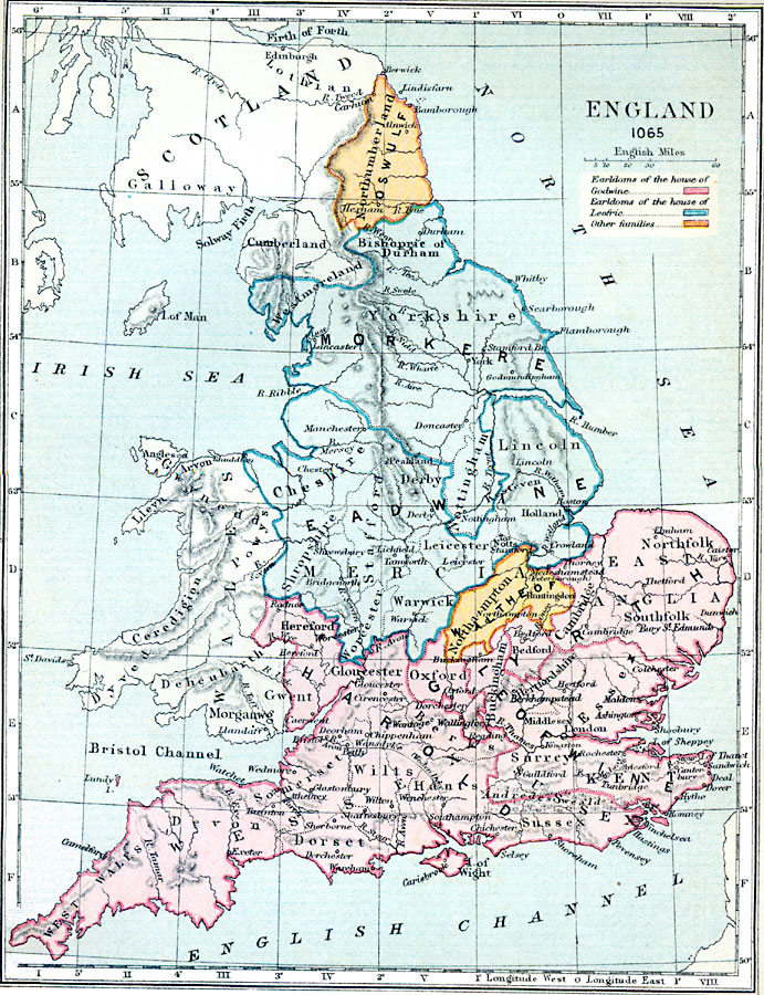
Description: A map of England in 1065, showing the territorial boundaries prior to the Norman conquest. The map is color–coded to show the Earldoms of the House of Godwine, the Earldoms of the House of Leofric, and the areas held by other families. The map shows shire boundaries, major cities, and significant sites of the period, rivers, coastal features, and terrain.
Place Names: United Kingdom, Scotland, �Galloway, �Cumberland, �Oswulf, �Northumberland, �Northampton, �Kent, �East Anglia, �London, �Sussex, �Isle of Wight, �Devon, �Dorchester, �Edinborough, �Edinburgh, �Derby, �Lincoln, �Gloucester, �Hereford, �Leicester, �Cheshir
ISO Topic Categories: boundaries,
inlandWaters,
location,
oceans,
society
Keywords: England, physical, �political, �statistical, �england 1065 CE, leofwine harold, earldoms of the house of godwine, earldoms of the house of leofric, physical features,
topographical, country borders,
major political subdivisions, ethnological, boundaries,
inlandWaters,
location,
oceans,
society, Unknown, 1065
Source: Samuel Rawson Gardiner D.C.L., L.L.D., School Atlas of English History (London, England: Longmans, Green, and Co., 1914) 9
Map Credit: Courtesy the private collection of Roy Winkelman |
|