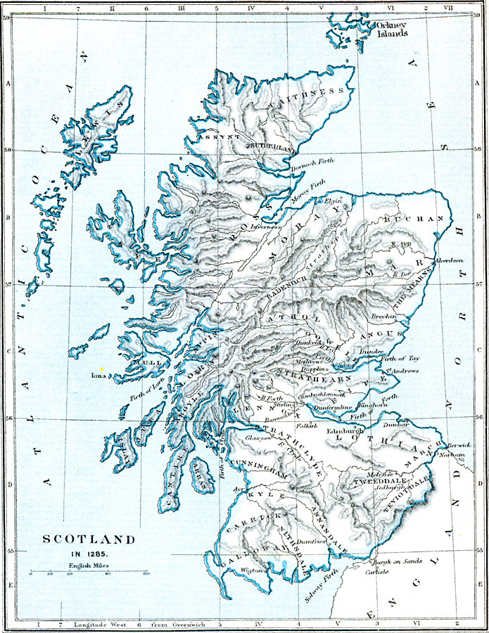
Description: A map of Scotland in 1285 at the time of King Alexander III, prior to the First War of Scottish Independence (1296–1328). The map shows the general political territories at the time, major cities, rivers, lakes, and islands, terrain and coastal features of the region.
Place Names: United Kingdom, Scotland, �Edinburgh, �Edinborough, �Angus, �Glasgow, �Falkirk, �Bannockburn, �Melrose, �Dundee, �Aberdeen, �Inverness, �Sutherland, �Caithness, �Mora
ISO Topic Categories: boundaries,
inlandWaters,
location,
oceans
Keywords: Scotland, physical, �political, �scotland in 1285 CE, physical features,
topographical, country borders,
major political subdivisions, boundaries,
inlandWaters,
location,
oceans, Unknown, 1285
Source: Samuel Rawson Gardiner D.C.L., L.L.D., School Atlas of English History (London, England: Longmans, Green, and Co.1, 1914) 13
Map Credit: Courtesy the private collection of Roy Winkelman |
|