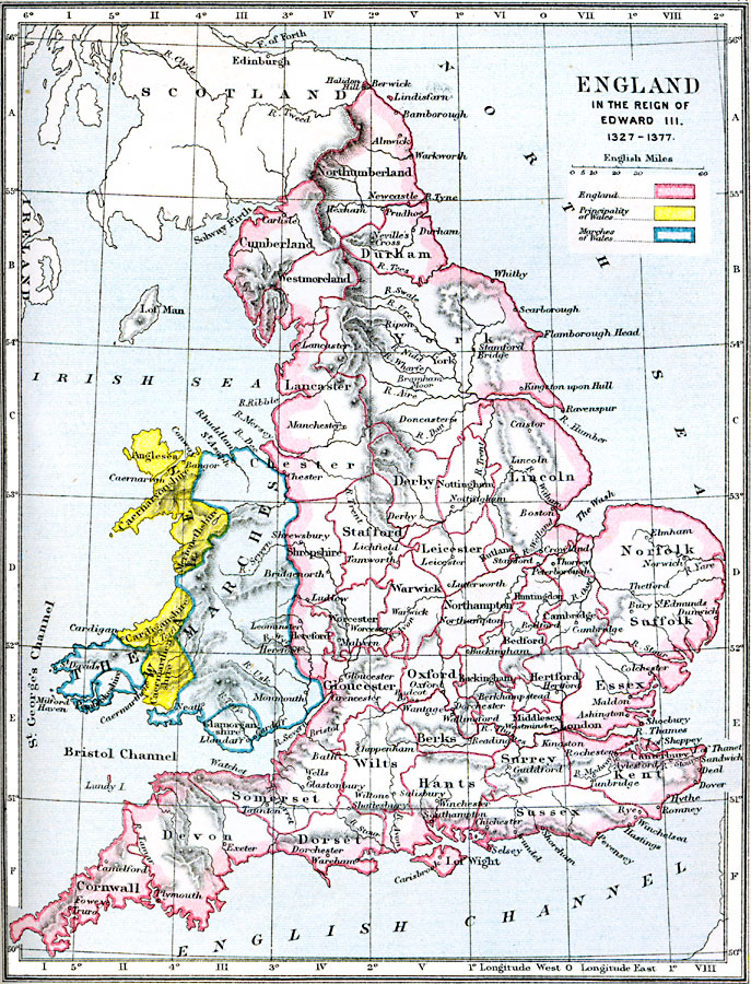
Description: A map of England and Wales during the reign of Edward III, between 1327 and 1377. The map is color–coded to show the counties or shires in England, the Principality of Wales, and the Marches of Wales. The map shows major cities, terrain, rivers, and coastal features.
Place Names: United Kingdom, Scotland, �Edinburgh, �Edinborough, �Northumberland, �Durham, �London, �Scarborough, �Lincoln, �Boston, �Lancaster, �Salisbury, �Winchester, �Cornwall, �Dover, �Gloucester, �Oxford, �Cambridge, �Middlese
ISO Topic Categories: boundaries,
inlandWaters,
location,
oceans
Keywords: England in the Reign of Edward III, physical, �political, �england in the reign of edward iii 1327-1377, principality of wales, marches of wales, physical features,
topographical, country borders,
major political subdivisions, boundaries,
inlandWaters,
location,
oceans, Unknown, 1327–1377
Source: Samuel Rawson Gardiner D.C.L., L.L.D., School Atlas of English History (London, England: Longmans, Green, and Co.1, 1914) 14
Map Credit: Courtesy the private collection of Roy Winkelman |
|