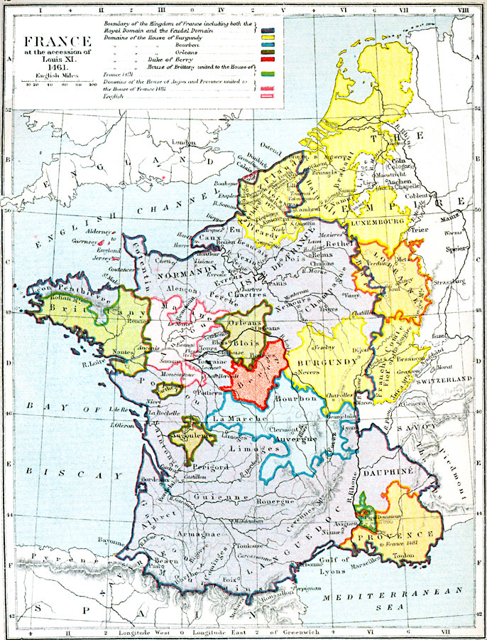
Description: Map showing France at the time of the accession of Louis XI in 1461.
Place Names: France, Paris, �Orleans, �Troyes, �Nevers, �Dijou, �Clermont, �Metz, �Verdun, �Aachen, �Rouen, �Niort, �Monterea
ISO Topic Categories: inlandWaters,
location,
oceans,
boundaries
Keywords: France at the Accession of Louis XI, physical, �political, �historical, �france at the accession of louis xi, boundary of kingdom of france including royal domain and feudal domain, domains of the house of burgundy, bourbon, orleans, duke of berry, house of brittany united to house of france 1491, domains of the house of anjou and provence united to house of france 1481, english, physical features, country borders,
major political subdivisions, historical event, inlandWaters,
location,
oceans,
boundaries, Unknown, 1461
Source: Samuel Rawson Gardiner D.C.L., L.L.D., School Atlas of English History (London, England: Longmans, Green, and Co.1, 1914) 19
Map Credit: Courtesy the private collection of Roy Winkelman |
|