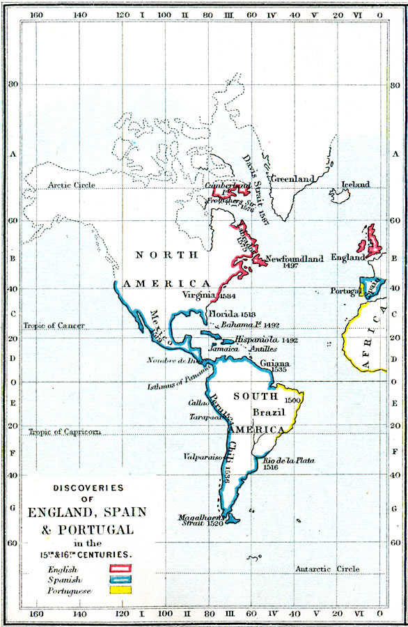
Description: Map showing the discoveries of land in the new world by England, Spain and Portugal in the 15th and 16th centuries.
Place Names: Regional Americas, Africa, �Europe, �North America, �South Americ
ISO Topic Categories: physical, �political, �historical, kWorldAmericas, kWorldAtlantic
Keywords: Discoveries of England, Spain and Portugal, physical, �political, �historical, �discoveries and exploration of the new world by England and Spain and Portugal in the 15th and 16th centuries, english, spanish, portuguese, physical features, country borders, historical event, physical, �political, �historical, kWorldAmericas, kWorldAtlantic, Unknown, 1400–1599
Source: Samuel Rawson Gardiner D.C.L., L.L.D., School Atlas of English History (London, England: Longmans, Green, and Co.1, 1914) 25
Map Credit: Courtesy the private collection of Roy Winkelman |
|