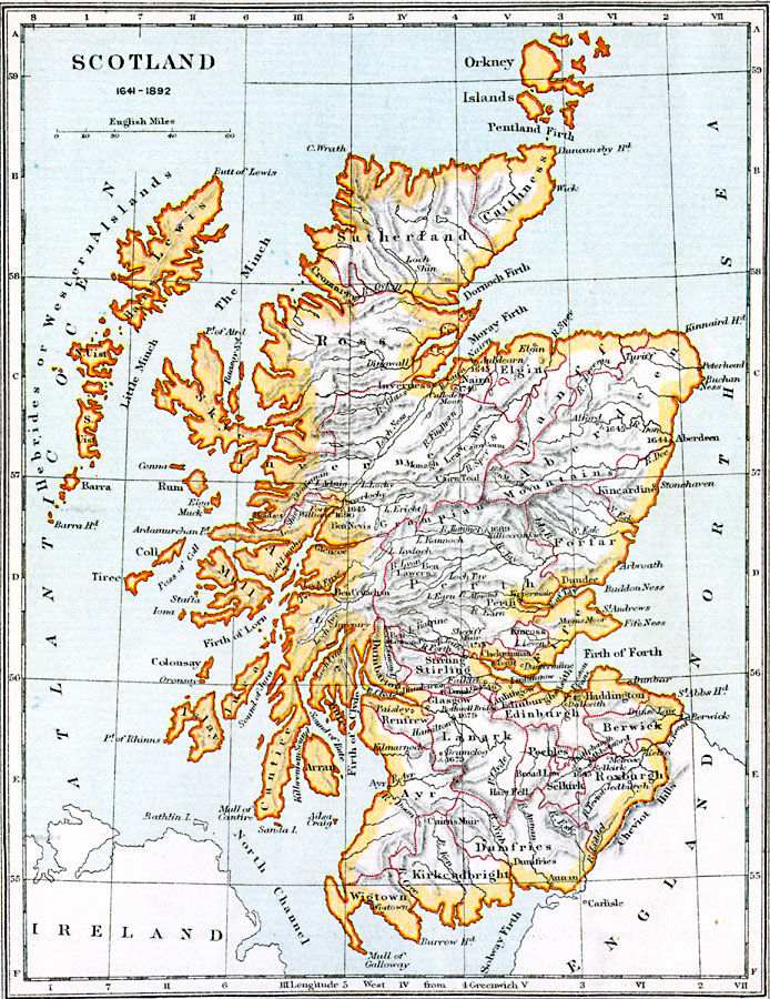
Description: A map of Scotland from prior to the beginning of the First English Civil War (1641) to 1892. The map shows counties, major cities, towns, and ports, significant battle sites with dates given, terrain and coastal features, rivers, lakes, and islands of the region.
Place Names: United Kingdom, Dumfries, �Perth, �Selkirk, �Peebles, �Edinburgh, �Edinborough, �Glasgow, �Stirling, �Dundee, �Kincardine, �Inverness, �Caithness, �Sutherland, �Ross, �Aberdee
ISO Topic Categories: inlandWaters,
location,
oceans,
boundaries
Keywords: Scotland, physical, �political, �scotland 1641 to 1892, physical features, major political subdivisions,
country borders, inlandWaters,
location,
oceans,
boundaries, Unknown, 1641–1892
Source: Samuel Rawson Gardiner D.C.L., L.L.D., School Atlas of English History (London, England: Longmans, Green, and Co.1, 1914) 33
Map Credit: Courtesy the private collection of Roy Winkelman |
|