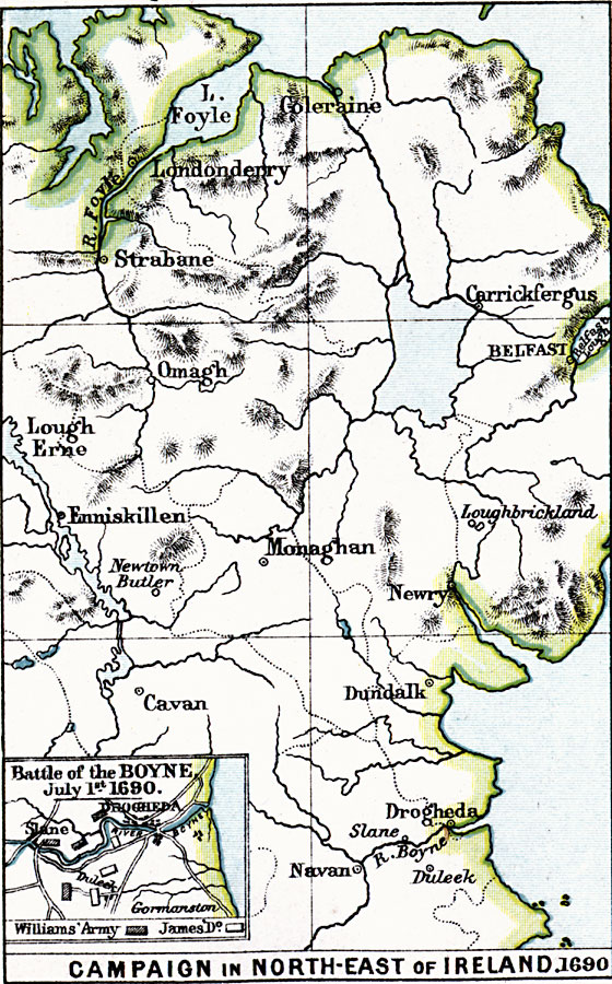
Description: A map of Ulster in the north–east of Ireland during the War of Two Kings (Williamite War or Jacobite War), showing the campaigns in the region, including the siege of Londonderry (Derry), Enniskillen, Battle of Newtown Butler (1689), the Schomberg campaign (1689) from Carrickfergus to Dundalk, and the campaign of William of Orange (William III) to Drogheda (1690). An inset map details the Battle of the Boyne on July 1, 1690, showing the positions of the forces under William III and the forces under James II.
Place Names: Ireland, Monaghan, �Newry, �Dundalk, �Drogheda, �Navan, �Duleek, �Enniskillen, �Cavan, �Omagh, �Strabane, �Londonderry, �Coleraine, �Carrickfergus, �Belfast, �Loughbricklan
ISO Topic Categories: inlandWaters,
location,
oceans
Keywords: Campaign in Northeast Ireland, physical, �political, �historical, �campaign in northeast ireland 1690, �slane, drogheda, duleek, gormanston, williams' army, james domain, kBattle, physical features, other military, inlandWaters,
location,
oceans, Unknown, 1690
Source: Samuel Rawson Gardiner D.C.L., L.L.D., School Atlas of English History (London, England: Longmans, Green, and Co.1, 1914) 35
Map Credit: Courtesy the private collection of Roy Winkelman |
|