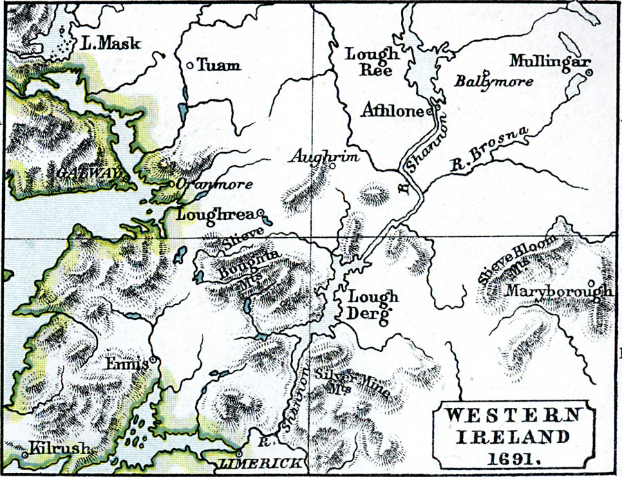
Description: A map of Western Ireland during the War of Two Kings (Williamite War or Jacobite War), showing the campaigns in the region in 1691, including the siege of Limerick on the River Shannon and the final Battle of Aughrim on 12 July, 1691.
Place Names: Ireland, L. Mask, �Tuam, �Oranmore, �Loughrea, �Ennis, �Kilrush, �Limerick, �Lough Derg, �Aughrim, �Maryborough, �Ballymore, �Athlone, �Mullinga
ISO Topic Categories: inlandWaters,
location,
oceans
Keywords: Western Ireland, physical, �political, �western ireland 1691, physical features, inlandWaters,
location,
oceans, Unknown, 1691
Source: Samuel Rawson Gardiner D.C.L., L.L.D., School Atlas of English History (London, England: Longmans, Green, and Co.1, 1914) 36
Map Credit: Courtesy the private collection of Roy Winkelman |
|