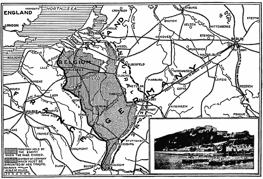
Description: A map of portions of France, Germany, Holland, Belgium, and Luxemburg at the end of World War I. The map is keyed to show territory held by Germany when war ended, the district of Germany which must be evacuated by her troops, and the Neutral Zone established by the allies at the end of the war.
Place Names: Western and Central Europe, Belgium, �England, �France, �Germany, �Holland, �North Se
ISO Topic Categories: location,
inlandWaters,
oceans,
boundaries
Keywords: Territory Held By The Enemy, borders, �historical, �physical, �railroads, �transportation, �World War I, kWWI, country borders, railroads, WWI, location,
inlandWaters,
oceans,
boundaries, Unknown, World War I
Source: Willis J. Abbot, Pictorial History of the World War (New York, NY: Leslie-Judge Company, 1919) 328
Map Credit: Courtesy the private collection of Roy Winkelman |
|
