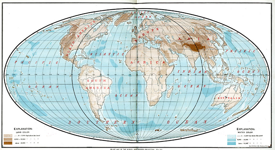
Description: A relief map from 1901 of the world on a Mollweide's Projection, showing general land elevations and water depths. The map is color–coded to show land elevations between sea level and 3,000 feet, 3,000 to 12,000 feet, and above 12,000 feet, and water depths from sea level to 6,000 feet, 6,000 to 18,000 feet, and below 18,000 feet. The oceans and land divisions are labeled.
Place Names: A Complete Map of Globes and Multi-continent, Africa, �Antarctica, �Asia, �Australia, �Europe, �North America, �South Americ
ISO Topic Categories: oceans,
location,
inlandWaters
Keywords: Relief Map of the World - Mollweide's Projection, borders, �hydrological, �physical, �topographical, �water depths, physical features,
topographical, country borders, water depths, oceans,
location,
inlandWaters, Other, 1901
Source: James A. Bowen, Grammar School Geography (Chicago, IL: Rand, McNally & Company, 1901) 12-13
Map Credit: Courtesy the private collection of Roy Winkelman |
|