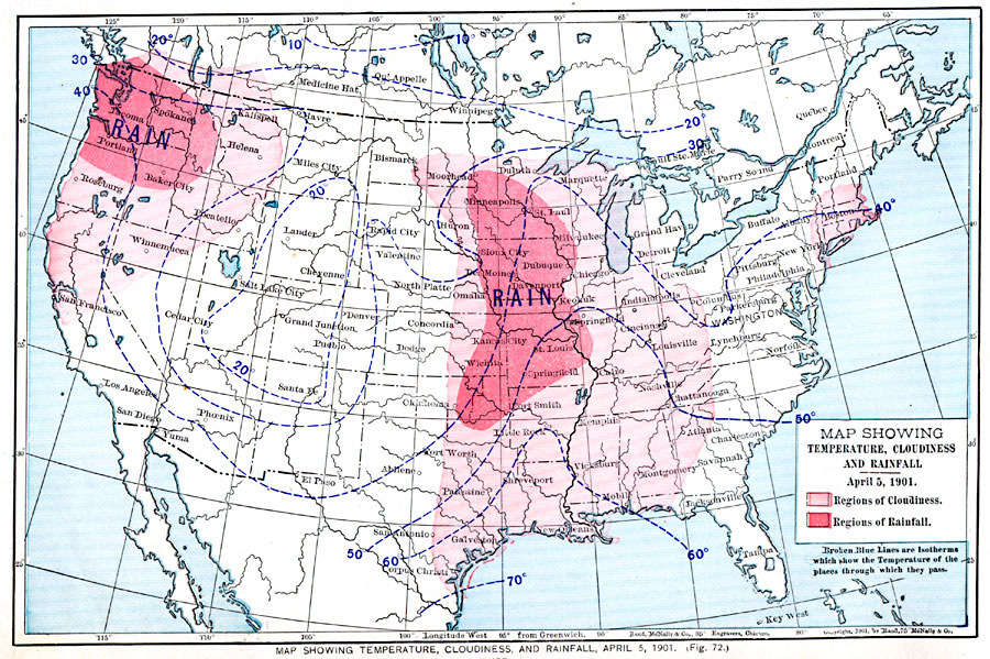
Description: A map from 1901 of the United States showing typical temperatures given in degrees Fahrenheit, cloudiness and rainfall distribution from a sample observed on April 5, 1901. The map is color coded to show regions of cloudiness and rainfall.
Place Names: Meteorology, Boston, �Chicago, �Houston, �Los Angeles, �Miami, �New Orleans, �New York, �San Diego, �Seattle, �Washington D.C., �temperature, �rainfal
ISO Topic Categories: oceans,
location,
inlandWaters,
climatologyMeteorologyAtmosphere
Keywords: Temperature, Cloudiness, and Rainfall in the United States, borders, �meteorological, �physical, �temperature, kClimate, kPrecipitation, temperature, oceans,
location,
inlandWaters,
climatologyMeteorologyAtmosphere, Unknown, April 5, 1901
Source: James A. Bowen, Grammar School Geography (Chicago, IL: Rand, McNally & Company, 1901) 38
Map Credit: Courtesy the private collection of Roy Winkelman |
|