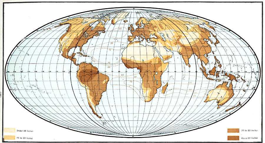
Description: A map from 1901 of the world on a Mollweide's Projection, showing the mean annual distribution of rainfall. The map is color–coded to show regions where annual rainfall averages less than 10 inches, regions of rainfall between 10 and 20 inches, 20 and 80 inches, and regions where rainfall exceeds 80 inches. This map includes oceanic rainfall distribution patterns.
Place Names: A Complete Map of Globes and Multi-continent, Africa, �Antarctica, �Asia, �Australia, �Europe, �North America, �South Americ
ISO Topic Categories: oceans,
location,
inlandWaters,
climatologyMeteorologyAtmosphere
Keywords: Rainfall Map of the World - Mollweide's Projection, borders, �meteorological, �physical, �rainfall, kClimate, kMapProjection, rainfall, oceans,
location,
inlandWaters,
climatologyMeteorologyAtmosphere, Other, 1901
Source: James A. Bowen, Grammar School Geography (Chicago, IL: Rand, McNally & Company, 1901) 44
Map Credit: Courtesy the private collection of Roy Winkelman |
|