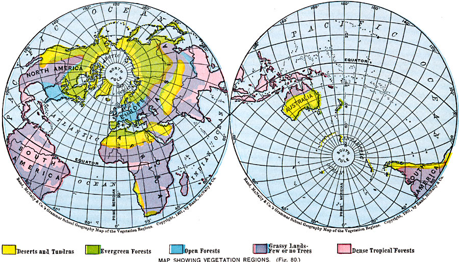
Description: A map from 1901 of the world on a hemisphere projection showing the general vegetation regions. The map is color–coded to show regions of deserts and tundra, evergreen forests, open forests, grassy lands with few or no trees, and dense tropical forests.
Place Names: A Complete Map of Globes and Multi-continent, Africa, �Antarctica, �Asia, �Australia, �Europe, �North America, �South Americ
ISO Topic Categories: oceans,
location,
inlandWaters,
climatologyMeteorologyAtmosphere
Keywords: Map Showing Vegetation Regions, borders, �physical, �statistical, �vegetation, kBiodiversity, vegetation, oceans,
location,
inlandWaters,
climatologyMeteorologyAtmosphere, Unknown, 1901
Source: James A. Bowen, Grammar School Geography (Chicago, IL: Rand, McNally & Company, 1901) 45
Map Credit: Courtesy the private collection of Roy Winkelman |
|