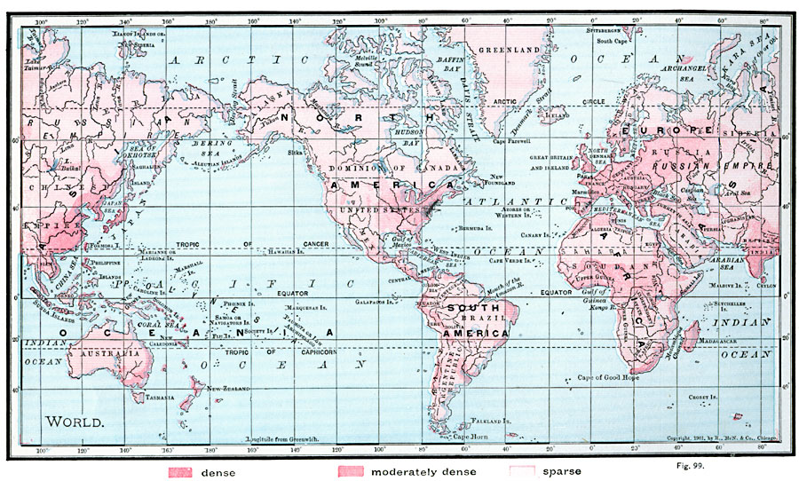
Description: A map from 1901 of the world on a Mercator's Projection, showing the general distribution of population density at the time. The map is color–coded to show areas of dense population, moderately dense, and areas of sparse population density.
Place Names: A Complete Map of Globes and Multi-continent, Africa, �Antarctica, �Asia, �Australia, �Europe, �North America, �South Americ
ISO Topic Categories: oceans,
location,
inlandWaters
Keywords: World Map of Population Density, country borders, �physical, �population, �statistical, kPopulation, country borders, population, oceans,
location,
inlandWaters, Unknown, 1901
Source: James A. Bowen, Grammar School Geography (Chicago, IL: Rand, McNally & Company, 1901) 58
Map Credit: Courtesy the private collection of Roy Winkelman |
|