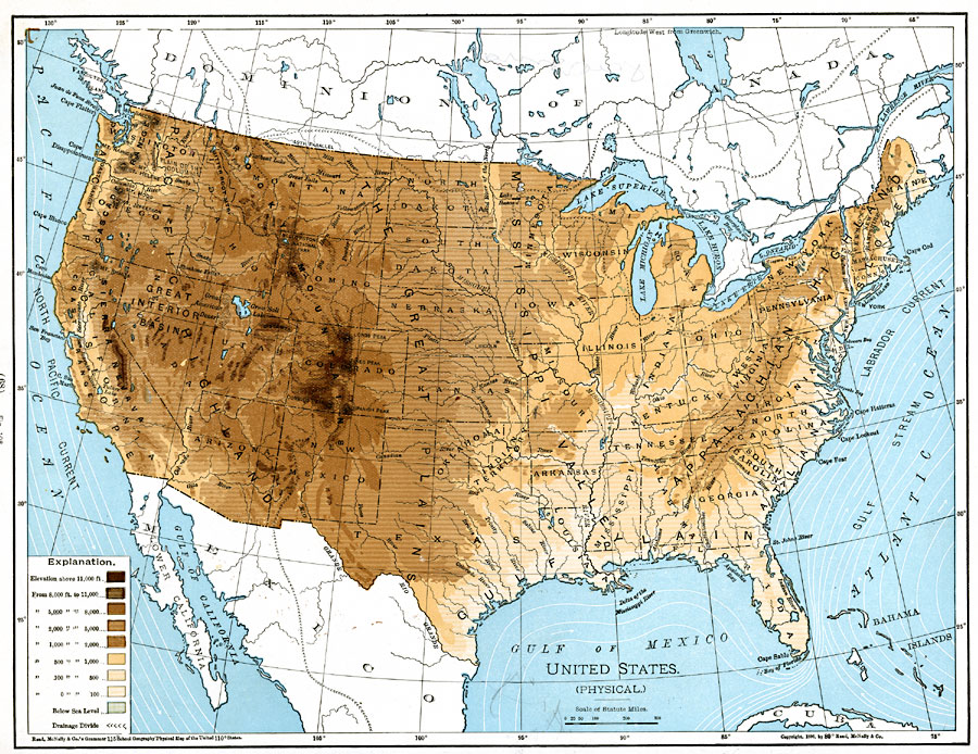
Description: A map from 1901 of the United States showing the physical features of the area, including mountain systems and highlands, plateaus, basins, plains, lakes, rivers, and coastal features. The map is color–coded to show land elevations from sea level to above 11,000 feet, and land below sea level. The map shows ocean currents, the watershed drainage divides, and state boundaries.
Place Names: A Complete Map of the United States, Boston, �Chicago, �Houston, �Los Angeles, �Miami, �New Orleans, �New York, �San Diego, �Seattle, �Washington D.C
ISO Topic Categories: oceans,
location,
inlandWaters
Keywords: United States, country borders, �physical, �topographical, � topographical,
physical features, country borders, oceans,
location,
inlandWaters, Unknown, 1901
Source: James A. Bowen, Grammar School Geography (Chicago, IL: Rand, McNally & Company, 1901) 68
Map Credit: Courtesy the private collection of Roy Winkelman |
|