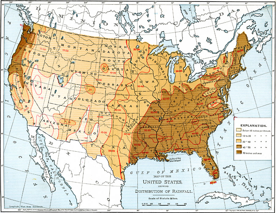
Description: A map from 1901 of the United States showing the mean annual distribution of rainfall given in inches per year. The map is color&ndash:coded to show rainfall ranging from below 10 inches to 70 inches or over per year. Isolines on the map identify areas of equal rainfall.
Place Names: Meteorology, Boston, �Chicago, �Houston, �Los Angeles, �Miami, �New Orleans, �New York, �San Diego, �Seattle, �Washington D.C., �rainfal
ISO Topic Categories: oceans,
location,
inlandWaters,
climatologyMeteorologyAtmosphere
Keywords: United States Showing Distribution of Rainfall, country borders, �meteorological,�physical, �rainfall, kClimate, kPrecipitation, physical features, country borders, rainfall, oceans,
location,
inlandWaters,
climatologyMeteorologyAtmosphere, Unknown, 1901
Source: James A. Bowen, Grammar School Geography (Chicago, IL: Rand, McNally & Company, 1901) 71
Map Credit: Courtesy the private collection of Roy Winkelman |
|