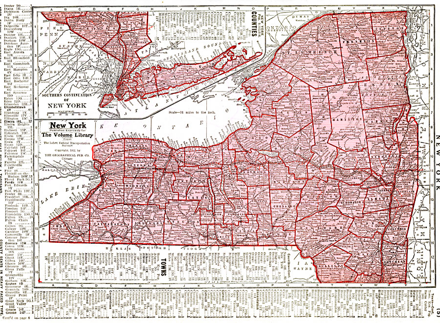
Description: A map from 1912 of New York showing the capital of Albany, counties and county seats, principal cities and towns, railroads, canals, mountains, lakes, and rivers. An inset map details southeastern New York and Long Island. A grid reference in the margins of the map lists counties with populations given in thousands and principal cities and towns with populations given in hundreds.
Place Names: New York, Albany, �Brooklyn, �Buffalo, �Kingston, �Oswego, �New York City, �Rochester, �Syracuse, �Troy, �Utic
ISO Topic Categories: boundaries,
transportation,
inlandWaters,
oceans,
location
Keywords: New York, political, �physical, �transportation, physical features, local jurisdictions,
major political subdivisions,
county borders, railroads, boundaries,
transportation,
inlandWaters,
oceans,
location, Unknown, 1912
Source: Henry W. Ruoff, The Volume Library (Chicago, IL: The W. E. Richardson Company, 1912) 5
Map Credit: Courtesy the private collection of Roy Winkelman |
|