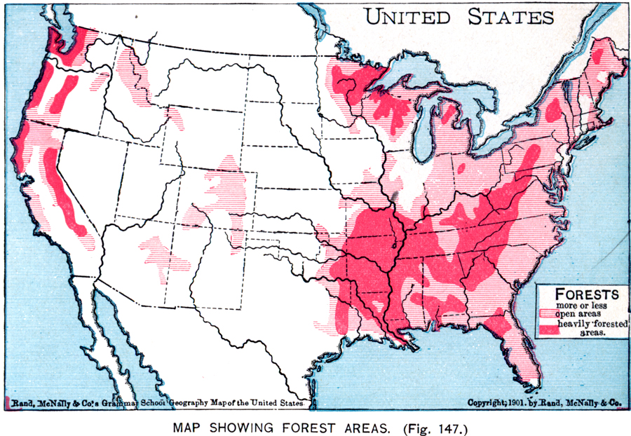
Description: A map from 1901 of the United States showing the principal forest regions. The map is color–coded to show heavily forested areas and areas where forests occur in more or less open areas.
Place Names: Forestry, Boston, �Chicago, �Houston, �Los Angeles, �Miami, �New Orleans, �New York, �San Diego, �Seattle, �Washington D.C
ISO Topic Categories: oceans,
location,
inlandWaters
Keywords: Forest Areas of the United States, economic, �industry, �statistical, �vegetation, industry,
vegetation, oceans,
location,
inlandWaters, Unknown, 1901
Source: James A. Bowen, Grammar School Geography (Chicago, IL: Rand, McNally & Company, 1901) 97
Map Credit: Courtesy the private collection of Roy Winkelman |
|