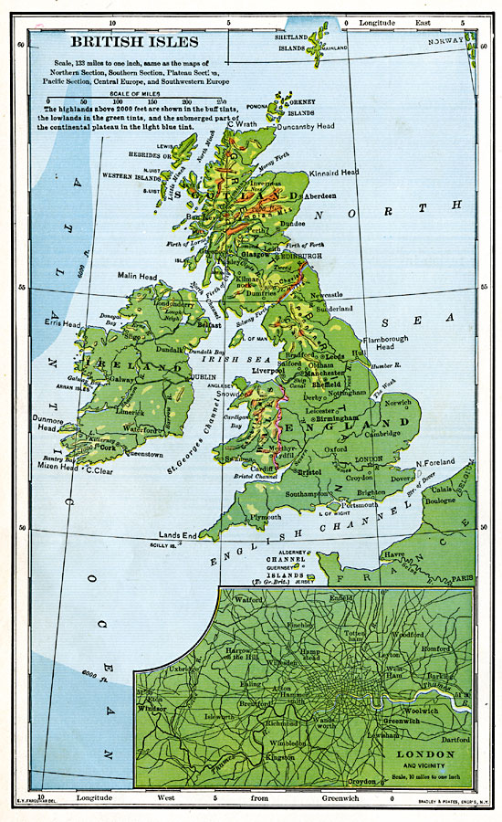
Description: A map from 1901 of the British Isles, showing borders at the time, major cities, rivers, and coastal features. The map is color–coded to show general land elevations over 2000 feet above sea level in buff tints, lowlands in green, and the submerged part of the continental plateau in light blue tint. An inset map details the city of London and vicinity.
Place Names: British Isles, Aberdeen, �Dundee, �Glasgow, �Dumfries, �Liverpool, �Leeds, �Manchester, �Sheffield, �Birmingham, �Bristol, �London, �Belfast, �Dundalk, �Dublin, �Limerick, �Cor
ISO Topic Categories: boundaries,
inlandWaters,
location,
oceans,
transportation
Keywords: British Isles and London, physical, �political, �transportation, physical features, country borders, railroads,
roads, boundaries,
inlandWaters,
location,
oceans,
transportation, Unknown, 1901
Source: Jacques W. Redway, Natural Advanced Geography (New York, NY: American Book Company, 1901) 122
Map Credit: Courtesy the private collection of Roy Winkelman |
|