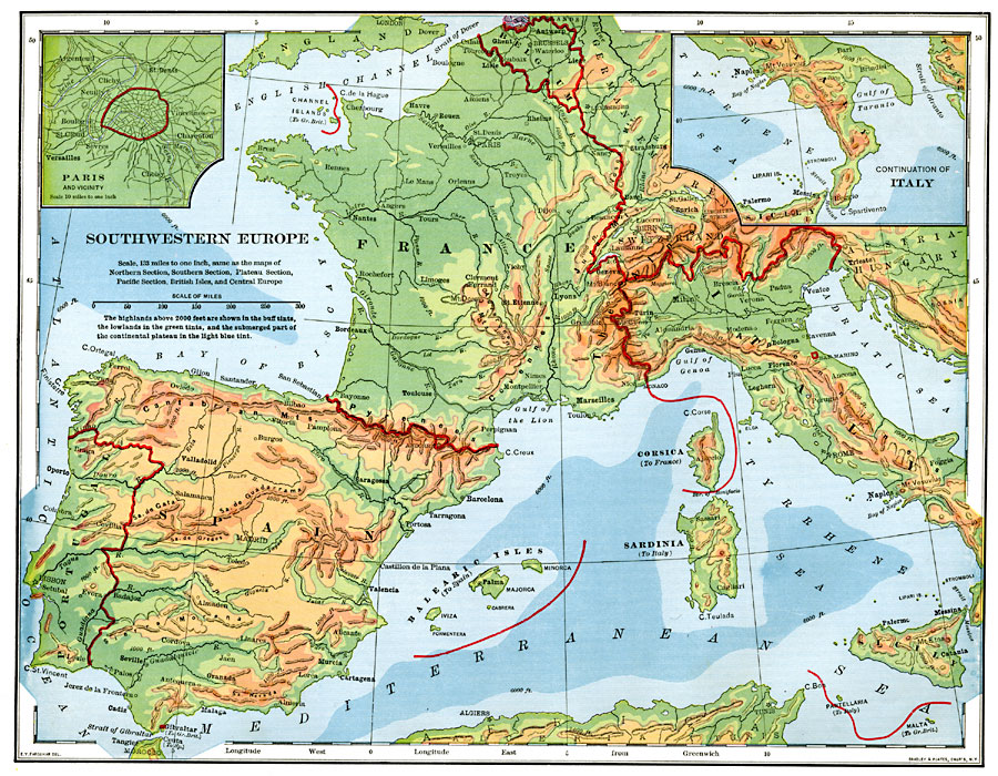
Description: A map from 1901 of Southwestern Europe, showing borders at the time, major cities, rivers, and coastal features. The map is color–coded to show general land elevations over 2000 feet above sea level in buff tints, lowlands in green, the lowlands below sea level in purple, and the submerged part of the continental plateau in light blue tint.. The countries include Belgium, France, Switzerland, Italy, Spain, Andorra, Portugal, the Channel Islands to Great Britain, Corsica to France, Sardinia and Sicily to Italy, and the Balearic Islands to Spain. A continuation of the southern portion of Italy is included, as well as an inset map detailing Paris and vicinity.
Place Names: Western and Central Europe, Portugal, �Spain, �France, �England, �Italy, �German Empire, �Belgium, �Switzerland, �Austria-Hungary, �Netherlands, �Pari
ISO Topic Categories: boundaries,
inlandWaters,
location,
oceans
Keywords: Southwestern Europe, physical, �political, physical features, country borders, boundaries,
inlandWaters,
location,
oceans, Unknown, 1901
Source: Jacques W. Redway, Natural Advanced Geography (New York, NY: American Book Company, 1901) 131
Map Credit: Courtesy the private collection of Roy Winkelman |
|