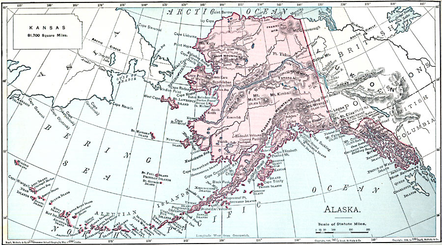
Description: A map of Alaska from 1901 showing the State capital at Sitka, cities, towns, ports, major rivers and mountain systems, coastal features, and islands. Elevations of prominent peaks are given, and an outline map of Kansas at the same map scale is included to show relative area size.
Place Names: Alaska, Anchorage, �Cordova, �Fairbanks, �Juneau, �Kenai, �Kodiak, �Nome, �Palmer, �Sitka, �Skagwa
ISO Topic Categories: oceans,
location,
inlandWaters
Keywords: Alaska, borders, �physical, kComparativeArea, country borders, oceans,
location,
inlandWaters, Unknown, 1901
Source: James A. Bowen, Grammar School Geography (Chicago, IL: Rand, McNally & Company, 1901) 133
Map Credit: Courtesy the private collection of Roy Winkelman |
|