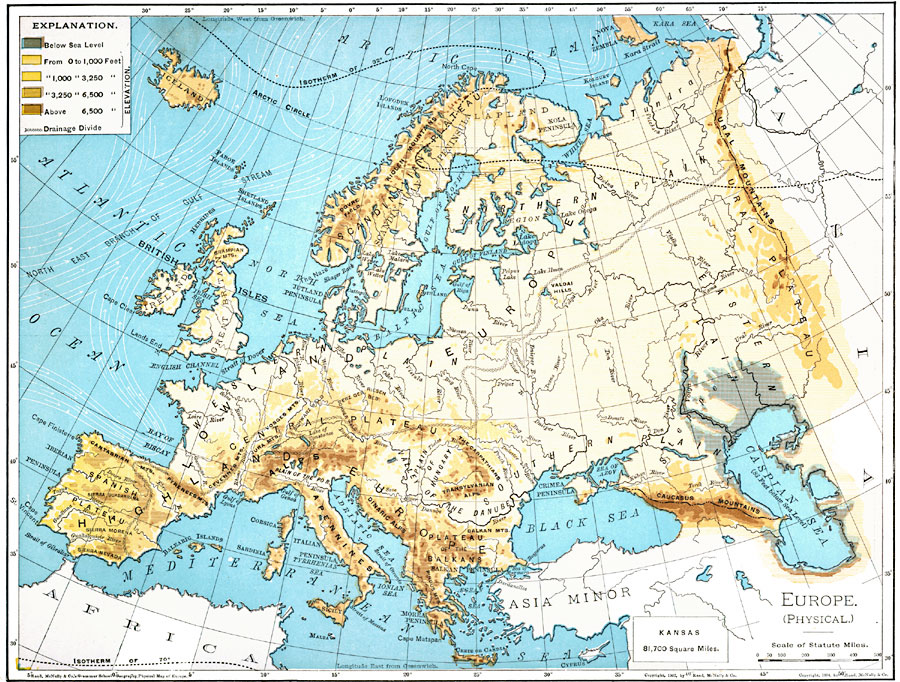
Description: A map from 1901 of Europe, showing the physical features of the region. This map is color–coded to show general elevations from sea level to over 6,500 feet, mountain systems, drainage divides, lakes, rivers, coastal features, and the major ocean currents with direction of flow given. The area to the north of the Caspian Sea that lies below sea level is shown. The temperate isotherm of mean annual 70° and the cold isotherm of 32° are given in Fahrenheit. This map shows the Arctic and Atlantic oceans, the North Sea, Baltic, Mediterranean, Adriatic, Ionian, &Aelig;gean, Black, and Caspian seas, coastal features, volcanoes, prominent peaks, and major rivers, as well as the physiographic regions of plateaus, basins, lowlands and highlands, and the watershed drainage divide. An outline map of Kansas is included at the same map scale to show the comparative area size relationship.
Place Names: A Complete Map of Europe, Highland, �Northern Plai
ISO Topic Categories: oceans,
location,
inlandWaters,
elevation
Keywords: Physical Features of Europe, borders, �physical, �topographical, topographical, country borders, oceans,
location,
inlandWaters,
elevation, Unknown, 1901
Source: James A. Bowen, Grammar School Geography (Chicago, IL: Rand, McNally & Company, 1901) 156
Map Credit: Courtesy the private collection of Roy Winkelman |
|