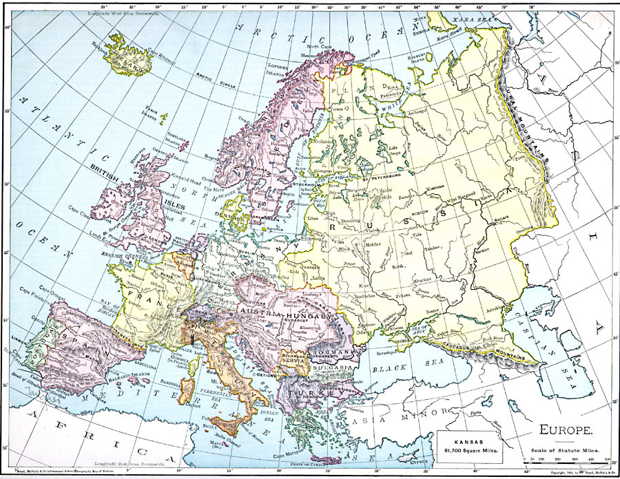
Description: A map from 1901 of Europe, showing the political boundaries at the time, capitals and other major cities, mountain and terrain features, lakes, rivers ,islands, and coastal features of the region. The physical division between Europe and Asia is given as the Ural Mountains, Ural River, the Caucasus Mountains, and the Bosporus. An outline map of Kansas at the same map scale shows relative comparative area size.
Place Names: A Complete Map of Europe, France, �Germany, �Greece, �Italy, �Poland, �Portugal, �Romania, �Spain, �Sweden, �United Kingdo
ISO Topic Categories: oceans,
location,
inlandWaters
Keywords: Europe, borders, �physical, kComparativeArea, country borders, oceans,
location,
inlandWaters, Unknown, 1901
Source: James A. Bowen, Grammar School Geography (Chicago, IL: Rand, McNally & Company, 1901) 158
Map Credit: Courtesy the private collection of Roy Winkelman |
|