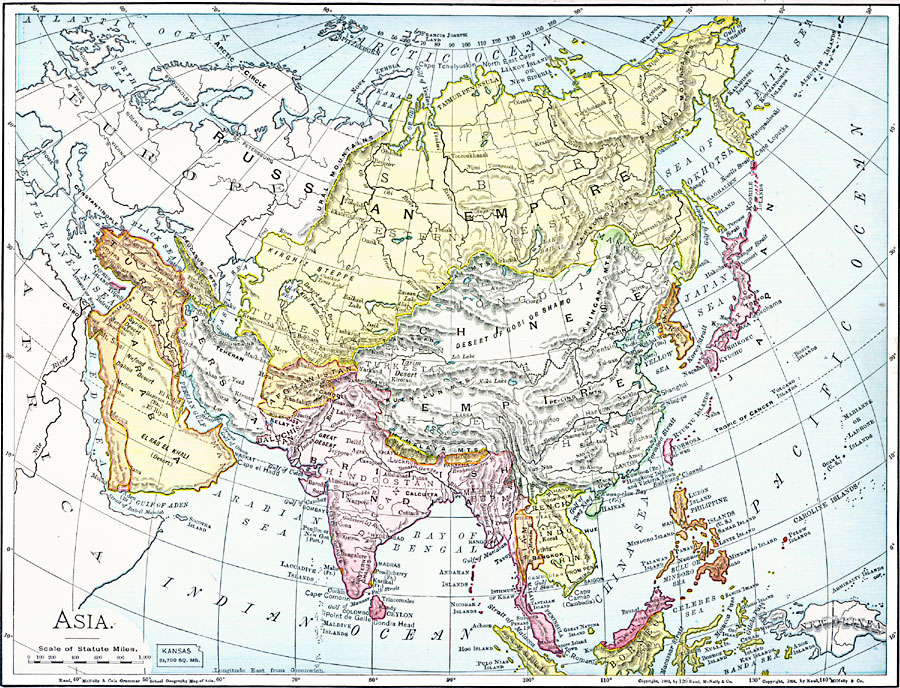
Description: A map of Asia from 1901 showing the political boundaries of the region at the time, including the extent of the Russian, Ottoman Turk, Chinese, and Japanese empires, the British and French possessions in India and Indo–China, and the United States possession of the Philippine Islands. The map shows capitals and major cities, mountain systems and terrain, rivers, coastal features, and islands. An outline map of Kansas at the same map scale is included to show comparative area size.
Place Names: A Complete Map of Asia, China, �India, �Indonesia, �Japan, �Kazakhstan, �Mongolia, �Pakistan, �Phillipines, �Russia, �Thailan
ISO Topic Categories: oceans,
location,
inlandWaters
Keywords: Asia, borders, �physical, kComparativeArea, country borders, oceans,
location,
inlandWaters, Unknown, 1901
Source: James A. Bowen, Grammar School Geography (Chicago, IL: Rand, McNally & Company, 1901) 179
Map Credit: Courtesy the private collection of Roy Winkelman |
|